Sample Page: Difference between revisions
mNo edit summary |
mNo edit summary |
||
| (6 intermediate revisions by the same user not shown) | |||
| Line 1: | Line 1: | ||
== Overview == | |||
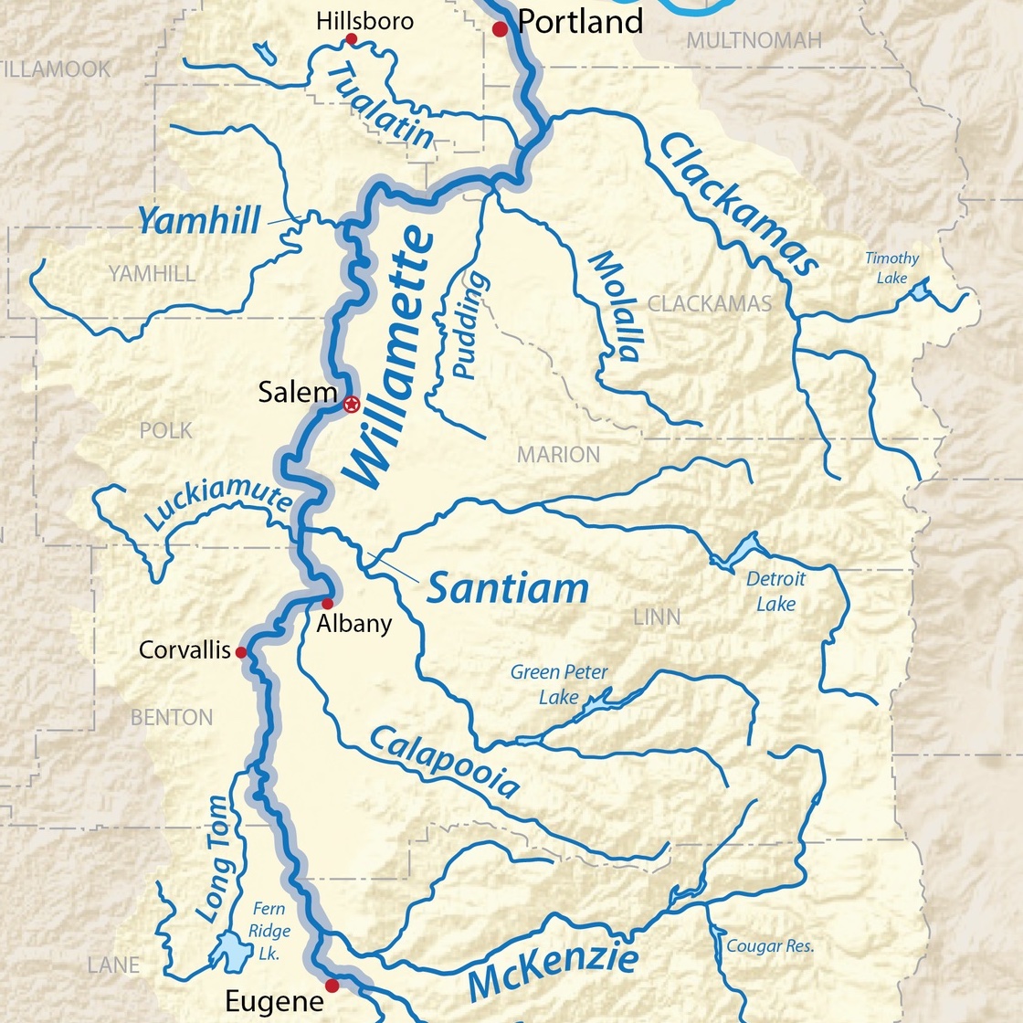
We have developed an interactive asset map for resources, hubs, projects, education opportunities, and more within the scope of the South Willamette Valley.There are many resources from the Directory page that could not be added to the map because they are not established in a single primary location. Here you can engage with and see where different organizations are located in your neighborhoods that could help build a more regenerative Willamette Valley. Some of our regional Willamette Valley Watersheds are also included as a way to see how the shape of the landscape interacts with human systems and development. | |||
Inclusion on this list is not an endorsement. All groups and links are already publicly accessible. | |||
'''Interactive South Willamette Valley Map:''' | |||
COMING SOON! | COMING SOON! | ||
What to know about the Southern Willamette Valley Interactive Map: | |||
* The map is organized in the same permaculture zones as seen on the directory page. Zone 4, the knowledge commons, will include every resource with a specified location. All of these resources and their locations and accessibility can and should be available to the commons. | |||
* Not all of the organizations and groups from the directory are on this map! Not every group has a single specified location within the South Willamette Valley. | |||
* The map is not the territory - meaning: observation and interaction in person and on the ground are extremely important when doing community and environmental work at any scale. This map is meant to be a directional tool and help connect community with local services, environment, and community. | |||
* If there is an organization or resource you think should be on this map, please reach out and let us know! | |||
Latest revision as of 18:41, 24 October 2025
Overview
We have developed an interactive asset map for resources, hubs, projects, education opportunities, and more within the scope of the South Willamette Valley.There are many resources from the Directory page that could not be added to the map because they are not established in a single primary location. Here you can engage with and see where different organizations are located in your neighborhoods that could help build a more regenerative Willamette Valley. Some of our regional Willamette Valley Watersheds are also included as a way to see how the shape of the landscape interacts with human systems and development.
Inclusion on this list is not an endorsement. All groups and links are already publicly accessible.
Interactive South Willamette Valley Map:
COMING SOON!
What to know about the Southern Willamette Valley Interactive Map:
- The map is organized in the same permaculture zones as seen on the directory page. Zone 4, the knowledge commons, will include every resource with a specified location. All of these resources and their locations and accessibility can and should be available to the commons.
- Not all of the organizations and groups from the directory are on this map! Not every group has a single specified location within the South Willamette Valley.
- The map is not the territory - meaning: observation and interaction in person and on the ground are extremely important when doing community and environmental work at any scale. This map is meant to be a directional tool and help connect community with local services, environment, and community.
- If there is an organization or resource you think should be on this map, please reach out and let us know!